

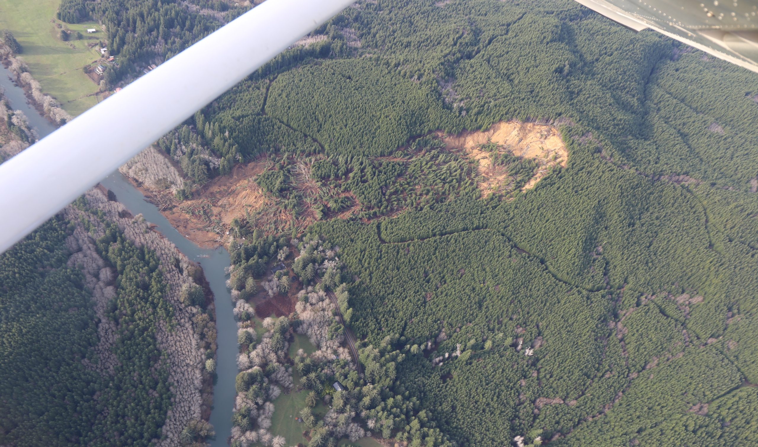
 An aerial photo taken from about 2,000 feet elevation on Dec. 29 shows the massive landslide that on Dec. 12 destroyed three houses and buried a quarter-mile section of Oregon Highway 229 about 10 miles north of Siletz. (Photo by Eric Squires)
It’s the airplane pilot equivalent of a Sunday afternoon drive – it’s a nice day so let’s go fly to the Oregon coast. And that’s what pilot Will Hobbs of Cornelius and passenger Eric Squires of Aloha did early the afternoon of a calm, sunny Monday, Dec. 29.
 An aerial photo shows the length of the slide that started on Weyerhaeuser property Dec. 12 and moved across Highway 229 and into the Siletz River. (Photo by Eric Squires)
Hobbs flew his Cessna four-seater along the coast as far south as Florence, making a slight detour inland so he could view and so Squires could photograph the massive Dec. 12 slide north of Siletz that buried a stretch of Oregon Highway 229. Hobbs, who has a second home in Depoe Bay, “specifically wanted to see the slide this time,” said Squires. “You get a different point of view at 2,000 feet.”
While the Oregon Department of Transportation flew a drone near the area the week after the slide, Squires’ photos – now spreading across social media – may be one of the first to get a higher, clear view of the size and complexity of the massive slide that started on Weyerhaeuser property and slide into the Siletz River, destroying three homes and damaging two others. ODOT is still trying to determine how it might address the landslide and the break in Highway 229 that separates the inland community of Siletz and Kernville to the west.
 The Oregon Department of Transportation says it may be months before it decides how or when it deals with the Dec. 12 slide that cut Highway 229 access between the communities of Siletz and Kernville. (Photo by Eric Squires)
Have a photo and short story to share? Send it here.


















Thanks for sharing this!